
Introduction: Field data collection is at the heart of effective GIS workflows — whether it's mapping property boundaries, documenting infrastructure, or conducting environmental surveys. Traditionally, this process involved manual forms, handwritten notes, and redundant data entry. Today, tools like ArcGIS Field Maps and QField allow you to collect structured data digitally, directly on-site, and link it to spatial features on a map. This blog walks you through two practical, mobile-based...
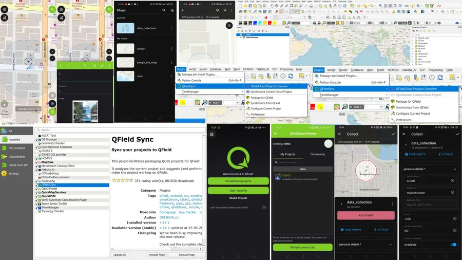
Field Data Collection Made Easy with QField and ArcGIS Field Maps: A Step-by-Step Comparison
Nithin B R