I am getting started with Proj's C++ API but I observe a huge discrepancy in the distance reported by proj_geod() between two points (384m) as compared to what googlemaps reports (284m).
Also when I ...
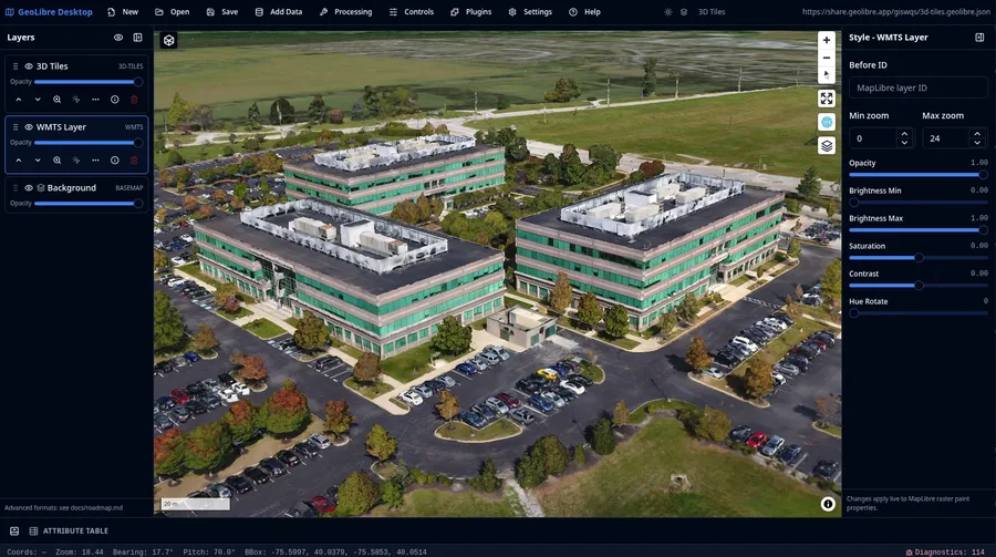
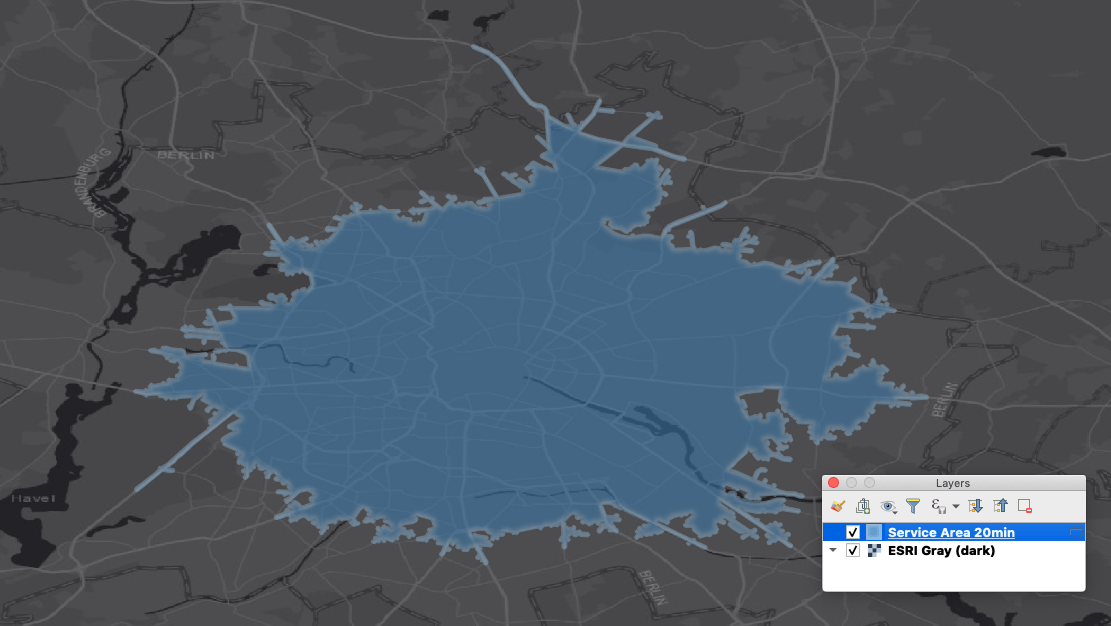
Cloud-native GIS platform
A lightweight, cloud-native GIS platform for visualizing, exploring, and analyzing geospatial data.
GeoLibre is built with Tauri, React, TypeScript, MapLibre GL JS, DuckDB-WASM Spatial, and deck.gl. The same workspace runs across desktop and web environments, adapting responsively to mobile screens, with fast local and cloud-native data work, project files, styling, plug…
This book delivers digital tools to manage arid deltas facing climate change, sea-level rise, and growing demand. It covers remote sensing, GIS, groundwater modeling, and AI forecasting. Case studies: Nile, Indus, and Colorado deltas (models to policy), including digital twins and sensor networks.
In this paper focused on the identification of Flood risk areas for essential developing flood preventive techniques. Hence, we have been finding the vulnerable sites and developing effective flood management strategies are important task. In this study, we have selected the Panchganga River, flowing in the Kolhapur district of Maharashtra, which are facing flood problems hence we have examined a…
If your team works with geospatial data, sooner or later you need a place where maps, layers, users, and edits live together. There are many capable SaaS platforms and proprietary solutions you can deploy on your own infrastructure, but there is another path: self-hosting an open-source Web GIS server. In this tutorial, we will deploy NextGIS Web on a low-cost VPS using Docker, and then configure…
Introduction The web is no longer limited to flat, static maps. With modern geospatial libraries like CesiumJS, developers can build immersive 3D worlds directly in the browser. From visualizing terrain and satellite imagery to displaying buildings, flight paths, and real-time geospatial data, CesiumJS makes it possible to create rich, interactive globe-based applications with ease. If you are wo…
Are you fascinated by maps, data and the power of technology to protect the natural world Then becoming a GIS Analyst might be the career for you. Check out this Ultimate Guide to becoming a GIS Analyst.
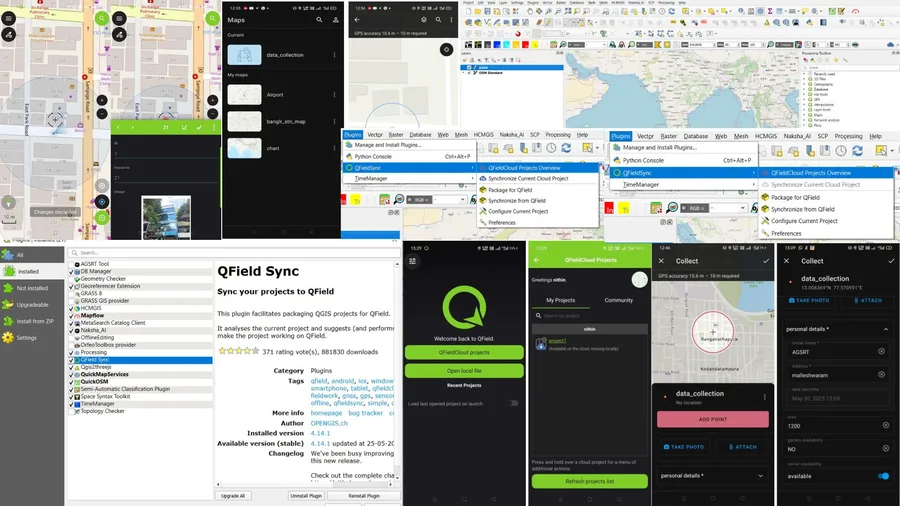
Introduction: Field data collection is at the heart of effective GIS workflows — whether it's mapping property boundaries, documenting infrastructure, or conducting environmental surveys. Traditionally, this process involved manual forms, handwritten notes, and redundant data entry. Today, tools like ArcGIS Field Maps and QField allow you to collect structured data digitally, directly on-site, an…
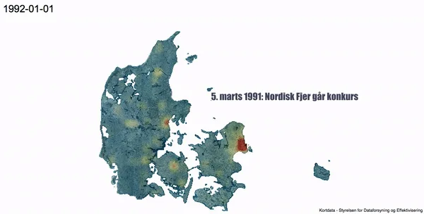
Why has this blog been so quiet lately? There are plenty of excuses for that. It doesn’t really matter either way, but since we’re on the subject, one thing that has kept me occupied recently is being back in school. I’m working on a certificate in GIS, and I’m hoping to make some cool maps. More on that later perhaps.
For now, I thought I’d share one of my final projects. I figured it was a good…
Explore the benefits of incorporating GIS into your academic major, regardless of your field of interest. Discover how GIS courses can equip you with valuable skills that will complement your chosen career path. The post Mapping a Path to Success Through GIS [VIDEO] first appeared on Rowan Blog .
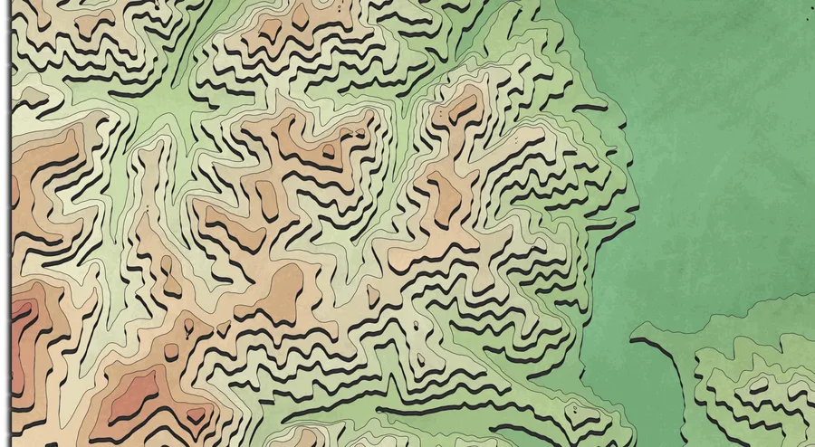
John Nelson did it again and amazed us by recreating AI topographic images with ArcGIS Pro. He showed the process in his latest youtube video. You may ask… The post Create Pseudo 3D Topographies in QGIS appeared first on Digital Geography .
Let me start by stating that I’m a solutions engineer for Esri, a geographic information systems (GIS) software vendor. In our world, physical geography and location matter. Esri has offered physical network inventory (PNI) solutions to the communications industry for many years. Which makes sense, because GIS is all about managing the geographic location of assets and spatially analyzing locat…
These days it seems the term resource optimization gets a lot of airtime and attention. I mean, who among us doesn’t want to save money, spend less, work smarter not harder, and make the most of what we have to use? At Esri, we believe the key to resource optimization is the incorporation of location into corporate strategy, communication and decision making. No one conveys that message better…
Limitations of 5G frequencies and fiber densification will create a dependency on GIS and geospatial technology not seen in previous wireless technologies. Check out the latest Geospatially Enabling Telecom Blog: TelcoProfessionals - Telecomblog Profile - Why the G in 5G should stand for Geospatial – Part 2
There are plenty of webmapping services out there. The best known might be mapbox, carto, arcgis online, google maps. But what they all share: they do not come… The post qgis2web in the wild appeared first on Digital Geography .
This year’s GeoConX meetup held at the Cobb Galleria Centre in Atlanta, Georgia, saw the largest number of utility and telecom GIS professionals ever gathered to share their work, collaborate on new projects, and discuss new ways of leveraging GIS and location intelligence to support the telecom business. The event kicked off with a half-day opening plenary session featuring geospatial thought l…
This years Esri Users Conference was another great event for GIS users in telecommunications. One apparent observation was that the need for GIS and maps in support of telecom workflows is growing, and not only for traditional telecom service providers but for other industries that are starting to, or have been, deploying communications networks. Because of this growing demand for GIS in teleco…
The ArcGIS REST API provides some interesting endpoints which can be used for free with a developer account. But how to do this in QGIS as you might… The post ArcGIS REST API and QGIS: a practical example appeared first on Digital Geography .
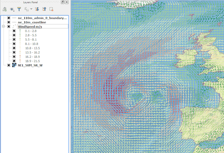
Introduction In this post we are going to look at how to get weather forecast data and display it as a layer in a desktop geographical information system… The post From Cloud to GIS: Getting Weather Data. appeared first on Digital Geography .
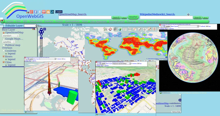
Perhaps you have already used in your work OpenWebGIS or just have seen it or read about it. Due to this system exists since 2014. But we will… The post Evolving Geographic Information System: OpenWebGIS plans & its crowdfunding campaign appeared first on Digital Geography .
gistechnology
research.io
Sign up to keep scrolling
Create your feed subscriptions, save articles, keep scrolling.