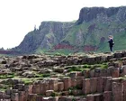
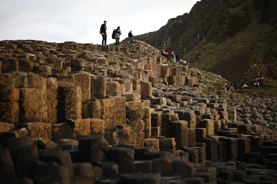
The history of an iconic UK landmark could be turned on its head, researchers have revealed. Scientists have uncovered fresh insights into how the Giant's Causeway came to exist. Research from the British Geological Survey shows Northern Ireland's volcanic history unfolded far more rapidly than experts previously believed. The volcanic activity that produced the Causeway's famous columns took pla…
Scientific Reports, Published online: 15 June 2026; doi:10.1038/s41598-026-55096-6 Benchmarking water saturation models for the Mishrif formation using dean–stark data
Geochronologists say Antrim coastline’s basalt columns developed over 5.5m years – 8m less than thought For centuries, the tale has been passed from generation to generation: how the Irish giant Finn McCool built the Giant’s Causeway in Northern Ireland to fight Benandonner, his Scottish rival, by hurling chunks of the Antrim coastline into the sea. Now, scientists have revealed it was intense vo…
Scientists have discovered that a major earthquake zone in Southern California may be carrying more built-up stress than at any time in the past 1,000 years. While this does not mean a large earthquake is about to happen, researchers say the findings highlight the importance of being prepared. Earthquakes occur when stress builds up along […] The post California’s “earthquake gate” may be under m…
earth-scienceseismology
Science News | Latest Updates on Scientific Discoveries | The Hindu
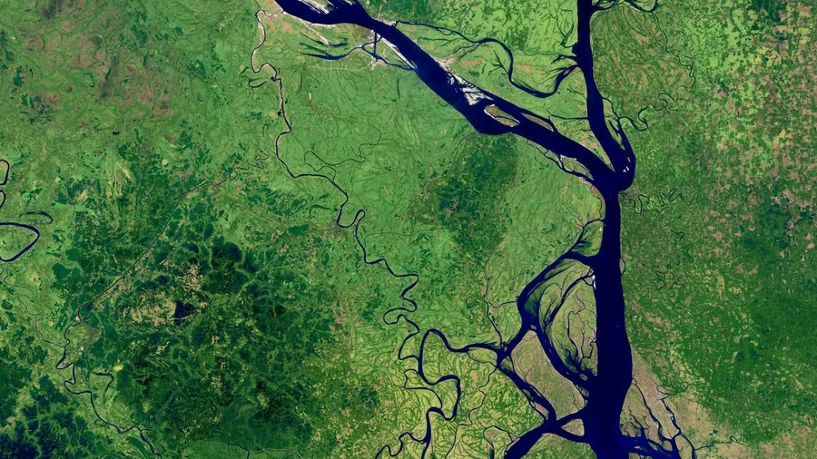
The new Padma barrage will lie just 180 km downstream of the Farakka barrage in West Bengal — which Bangladesh has blamed for the country’s periodic water scarcity. The Farakka is one of India’s largest with a feeder canal and was built to divert water from the Ganga to the Bhagirathi-Hoogly, and thus flush the Kolkata Port
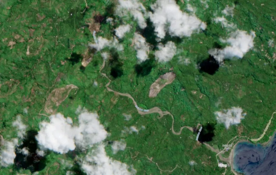
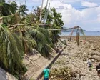
‘Coastal uplift’ exposes coral and kills marine life, as residents say shorelines extended by up to 200 metres A powerful earthquake that killed at least 61 people in the Philippines this week raised the seabed by as much as 2 metres (6.6 feet), exposing coral and harming marine life, the environment department said on Sunday. At least 40 people are still missing after the 7.8-magnitude tremor in…
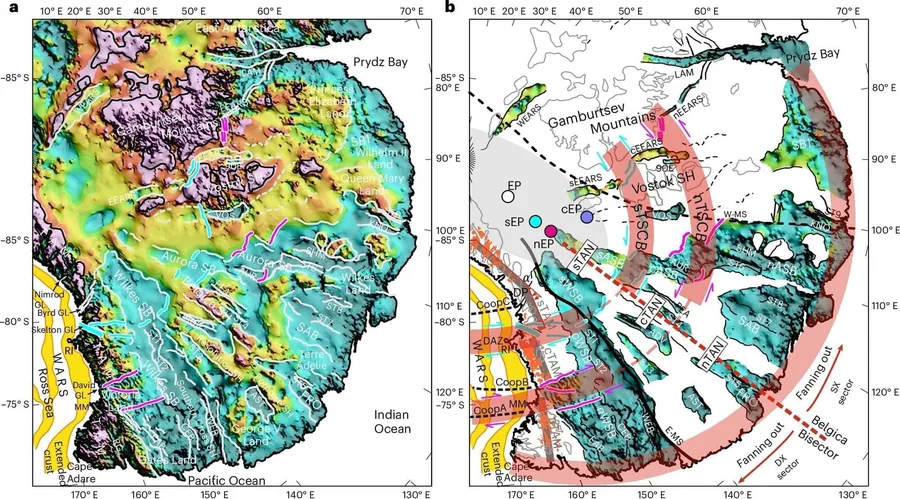
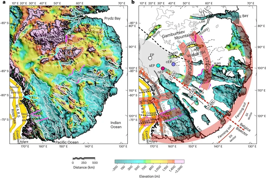
An international team of researchers including our Department of Geography has discovered a vast geological structure hidden beneath the East Antarctic Ice Sheet. The findings are published in the journal Nature Geoscience. The structure is made up of a system of enormous subglacial basins buried in ice over three kilometers thick in parts. Together, the […]
npj Climate and Atmospheric Science, Published online: 13 June 2026; doi:10.1038/s41612-026-01464-y A nonlinear explainable method for data-driven forecasting models in Earth system science
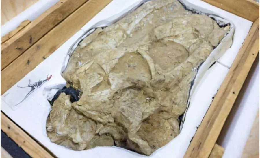
An ancient predator is once again at the center of attention, not because of how it lived millions of years ago, but because of the remarkable journey its fossils have taken in modern times.
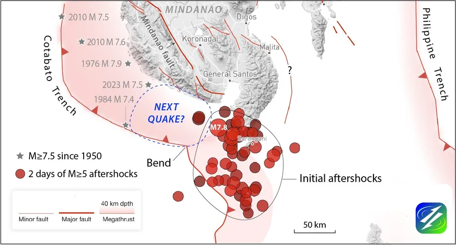
7.8-magnitude quake hit the southern island of Mindanao killing at least 55 people and leaving a trail of destruction It was just before midnight when the rescue team pulled the body from the rubble of a grocery store destroyed by the most powerful quake to hit the Philippines in half a century. The family wailed at the sight. “While tragic, it offered the family a painful consolation,” said Rene…
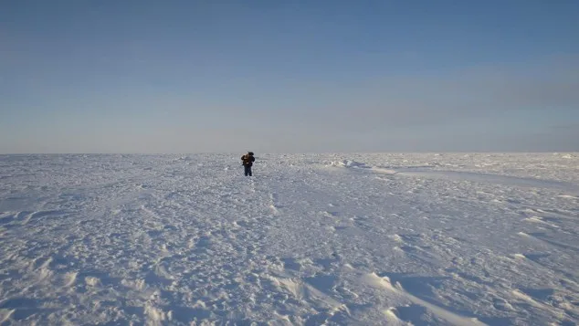
The first time I stood on sea ice, I could not tell which direction the coast was. A community member named Bryan could. That gap in situational awareness, between what a trained remote sensing scientist could read from the landscape and what a local hunter understood instinctively, turned out to mirror almost exactly the gap in our satellite data: ICESat-2 produces reliable freeboard across the …
The largest Philippines shock in a half century -- a magnitude 7.8 event -- struck an earthquake-weary country on June 7, 2026, shaking the southernmost island of Mindanao. As of this writing, the Philippines authorities are reporting 47 deaths, several building collapses, and extensive building and infrastructure damage in General Santos City, which lays 55 kilometers (35 miles) north of the ep…
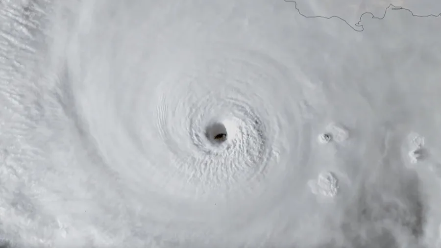
The arrival of El Niño is increasing confidence in a quieter-than-normal 2026 Atlantic hurricane season. Colorado State University now expects only 11 named storms this year, well below average. Still, forecasters warn that it only takes one landfalling hurricane to cause significant impacts, regardless of seasonal totals.
Be sure to vote for Group B in the poll at the bottom!
Canada - 37/24/1/0
Mount Meager in British Columbia. Credit: David Steers / Wikimedia Commons
I think many people don't believe that Canada has volcanoes. Not that it is a conspiracy...