


A satellite-data fusion algorithm maps atmospheric aerosols in three dimensions beyond narrow lidar tracks. By combining vertical profiles with geostationary observations, the method produces regional aerosol extinction fields and boundary-layer heights at high resolution. The advance could strengthen research on pollution transport, atmospheric stability, aerosol-boundary layer interactions, and climate processes.
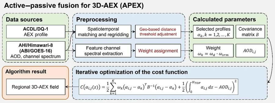
APEX Turns Sparse Satellite Tracks Into Regional Aerosol Maps
Chinese Academy of Sciences