
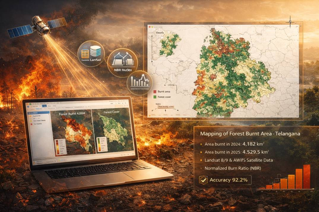
ABSTRACT The dynamic changes in forest fire regimes are affecting biodiversity and climate, therefore, mapping and monitoring burnt areas have become increasingly important, particularly during predominant fire seasons. Accurate mapping of burned areas is critical for proper resource allocation for combating fire hazards and prioritizing fire management strategies. The current study aimed to systematically map the spatial extent of forest burnt areas in Telangana state using multiple...
Forest Fire Mapping Using Remote Sensing: Burnt Area Analysis in Telangana with NBR and Landsat
Shijila P S