Laterolog (DLL) logging, utilizing deep and shallow detection depths, is instrumental in identifying and evaluating complex reservoirs such as coal measures. It effectively captures the resistivity contrast between the virgin zone and the invaded zone, providing crucial data for fluid identification, reservoir quality assessment, and fracture system characterization. However, the DLL response in …
earth-sciencegeophysics
Frontiers in Earth Science | New and Recent Articles
The long-offset transient electromagnetic method (LOTEM) offers a large depth of investigation and high sensitivity to subsurface resistivity variations, making it valuable for deep resource exploration, oil and gas prospecting, and engineering investigations. As exploration targets move to greater depths, increasingly undulating surface and subsurface interfaces and more complex structural setti…
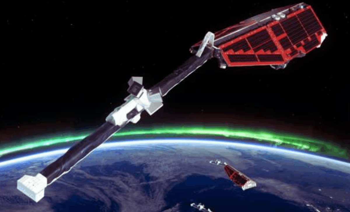
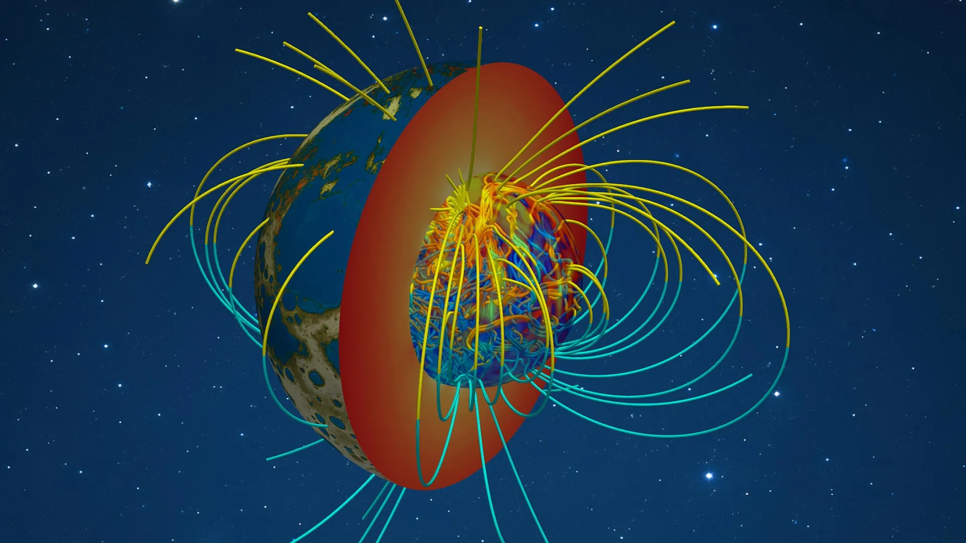
Our planet's liquid iron outer core is slowly giving up its secrets to a trio of satellites launched by ESA in 2013. Called Swarm, the three probes have been studying Earth's magnetic field at the source. In the process, they've revealed startling changes in a molten layer region 2,200 kilometers beneath the Pacific Ocean. In 2010, material in that area of Earth's outer core changed direction. In…
Paul A. Bedrosian·...·Adam Schultz and Gary D. Egbert
19d ago
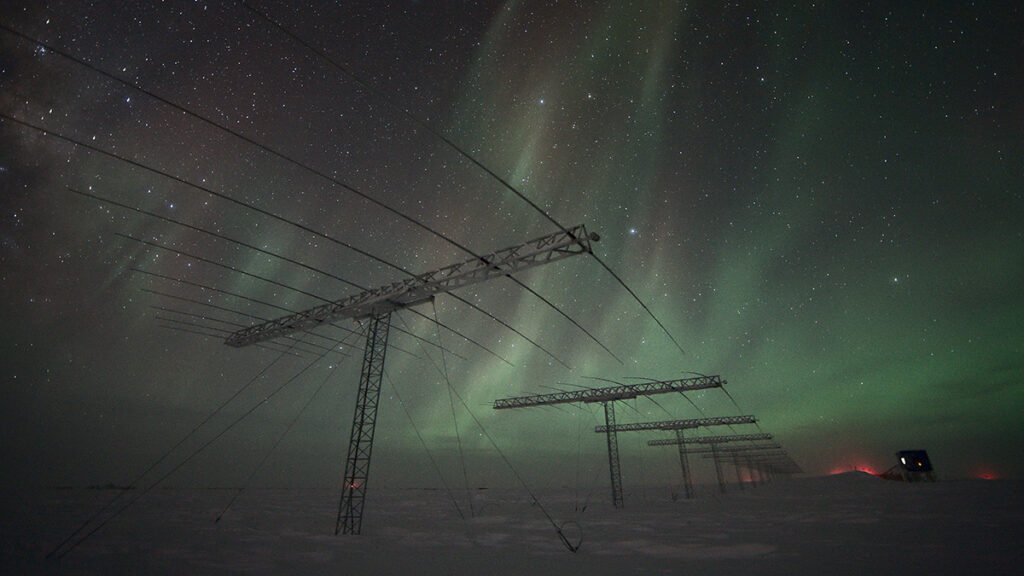
Installation of a USMTArray site in southern California in 2019. A central data logger (pictured) records electric and magnetic field variations at each site. Field personnel monitor initial data prior to leaving an instrument to record unattended for about 3 weeks. Credit: Kristin Pratscher
Quantinuum has entered into a scaled technical project with multinational integrated energy firm bp to develop quantum-hybrid algorithms for subsurface seismic imaging. The project transitions from a successful feasibility pilot into a production-oriented scaling phase designed to model more complex geophysical wave physics properties. The industrial application targets computational bottlenecks …
Accurate characterization of salt caverns is a prerequisite for evaluating the feasibility of Compressed Air Energy Storage (CAES), yet high-noise urban environments pose challenges for conventional active-source geophysical methods. To address this, our study utilized Microtremor Array Measurements (MAMs) based on the Spatial Autocorrelation (SPAC) method to characterize deep salt caverns for a …
A simple and accurate model for attenuation and dispersion caused by squirt flow in isotropic porous rocks
Alkhimenkov, Yury; Quintal, Beatriz
Seismic waves propagating in fluid-saturated porous rocks exhibit attenuation and velocity dispersion in a broad range of frequencies. At sonic and ultrasonic frequencies, the attenuation is predominantly caused by fluid flow in cracks and grain contacts, …
earth-sciencegeophysics
Frontiers in Earth Science | New and Recent Articles
Astronomical cycles have long been proposed as potential modulators of seismicity, yet their influence remains controversial due to inconsistent results and methodological limitations. In this study it was tested whether the 18.6-year lunar nodal cycle, expressed in Earth rotation through length-of-day (LOD) variations, is detectable in global seismicity using independent earthquake catalogs (ISC…
Receiver grouping strategies for hybrid geometric-mean reverse time migration
Bai, Tong; Lyu, Bin; Williamson, Paul; Nakata, Nori
Geometric-mean reverse time migration (GmRTM), a powerful crosscorrelation-based imaging method, generates higher resolution source images and is more robust to noise compared with conventional time-reversal imaging. The price to pay is the higher computational costs. …
earth-sciencegeophysics
Frontiers in Earth Science | New and Recent Articles
Shallow covered karst collapse is a prevalent geological hazard in Fuchuan County, Guangxi, China, posing severe threats to local engineering construction and human safety. To accurately identify subsurface karst structures and delineate collapse hazard zones, high-density electrical resistivity tomography (ERT) with Wenner, Schlumberger, and their combined array configurations was applied in a t…
Earth’s magnetic north pole has a new official position. The updated World Magnetic Model 2025, released by the National Centers for Environmental Information (NOAA) and the British Geological Survey, confirms the pole is drifting closer to Siberia.
That matters well beyond geophysics. The model keeps military and civilian planes, ships, submarines, and GPS units aligned with the planet’s changin…
Join us for a live webinar focused on accelerating and optimizing magnetometer data processing using GeoHammer. In this session, we will demonstrate practical workflows for transforming raw magnetic data into clear, interpretable results — faster and more efficiently.
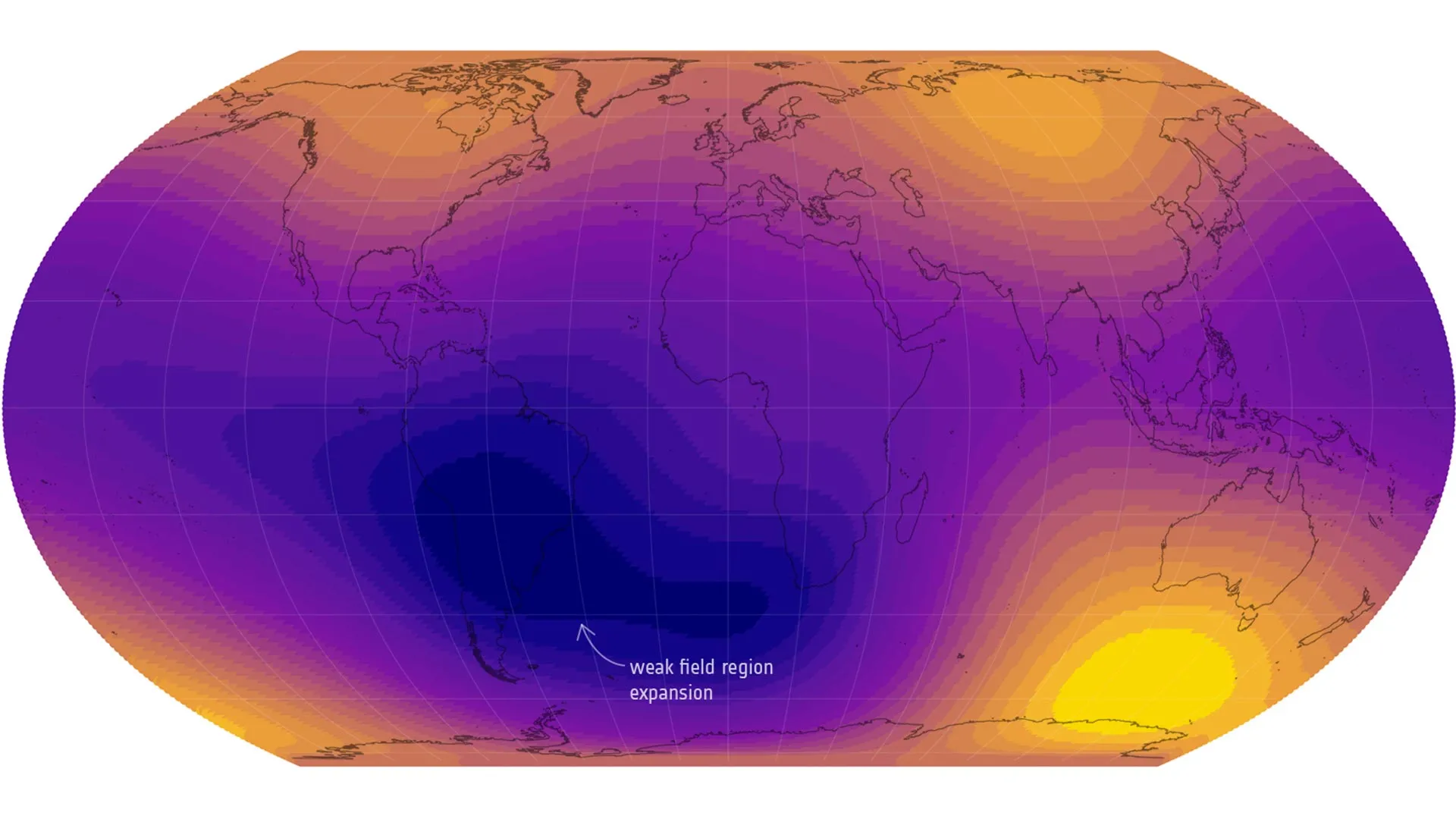
A giant weak spot in Earth’s magnetic field is now half the size of Europe
Earth’s magnetic field is on the move — and one giant weak spot over the Atlantic is getting dramatically bigger.
- Date:
- February 25, 2026
- Source:
- European Space Agency (ESA)
- Summary:
- Earth’s magnetic shield is shifting in dramatic ways. New data from ESA’s Swarm satellites show that the South Atlantic Anomaly —…
Researchers have recreated the eerie sound of Earth’s last magnetic pole flip using real ESA satellite data. Discover what our planet’s magnetic chaos really “sounded” like.
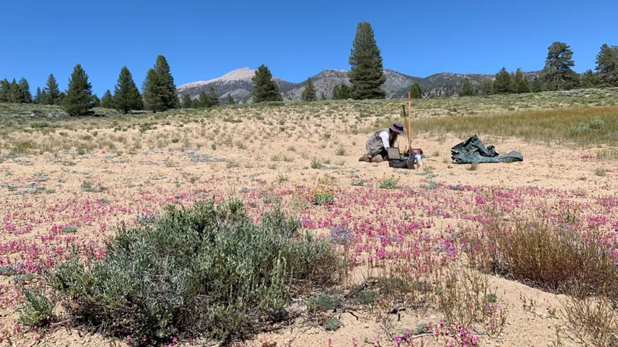
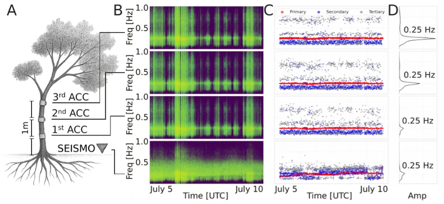
Post provided by Josefine Umlauft. We are a group of geophysicists, mathematicians, and ecologists who normally speak quite different scientific languages. This project brought us together through a shared curiosity: could the instruments and analytical tools originally developed for studying earthquakes also help us understand how trees move in the wind? The result, The Seismic Fingerprint of Wi…
New satellite data reveals alarming changes in Earth's magnetic field, highlighting a rapid weakening that could disrupt satellites and global technology.
Geophysicists have modeled how Earth’s magnetic field could form even when its core was fully liquid. By removing the effects of viscosity in their simulation, they revealed a self-sustaining dynamo that mirrors today’s mechanism. The results illuminate Earth’s early history, life’s origins, and the magnetism of other planets. Plus, it could help forecast future changes to our planet’s protective…
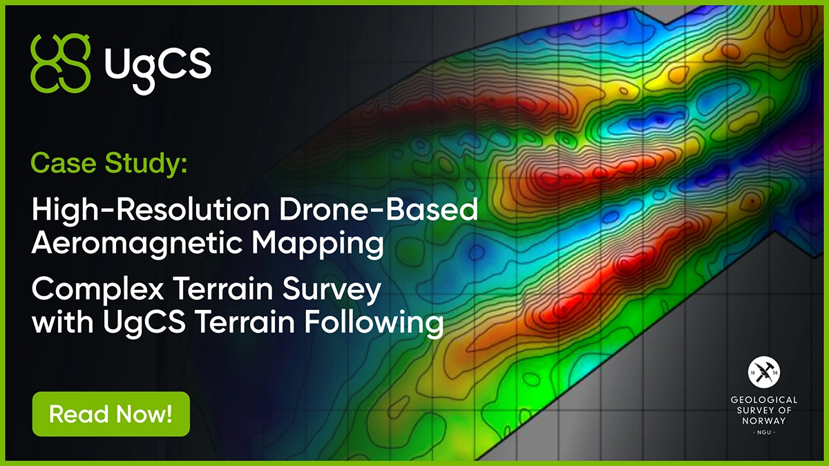
See how UgCS enabled a 10 km² aeromagnetic survey with constant 35m AGL terrain following, unlocking precise geophysical mapping for graphite deposits.
earth-sciencegeophysics
research.io
Sign up to keep scrolling
Create your feed subscriptions, save articles, keep scrolling.