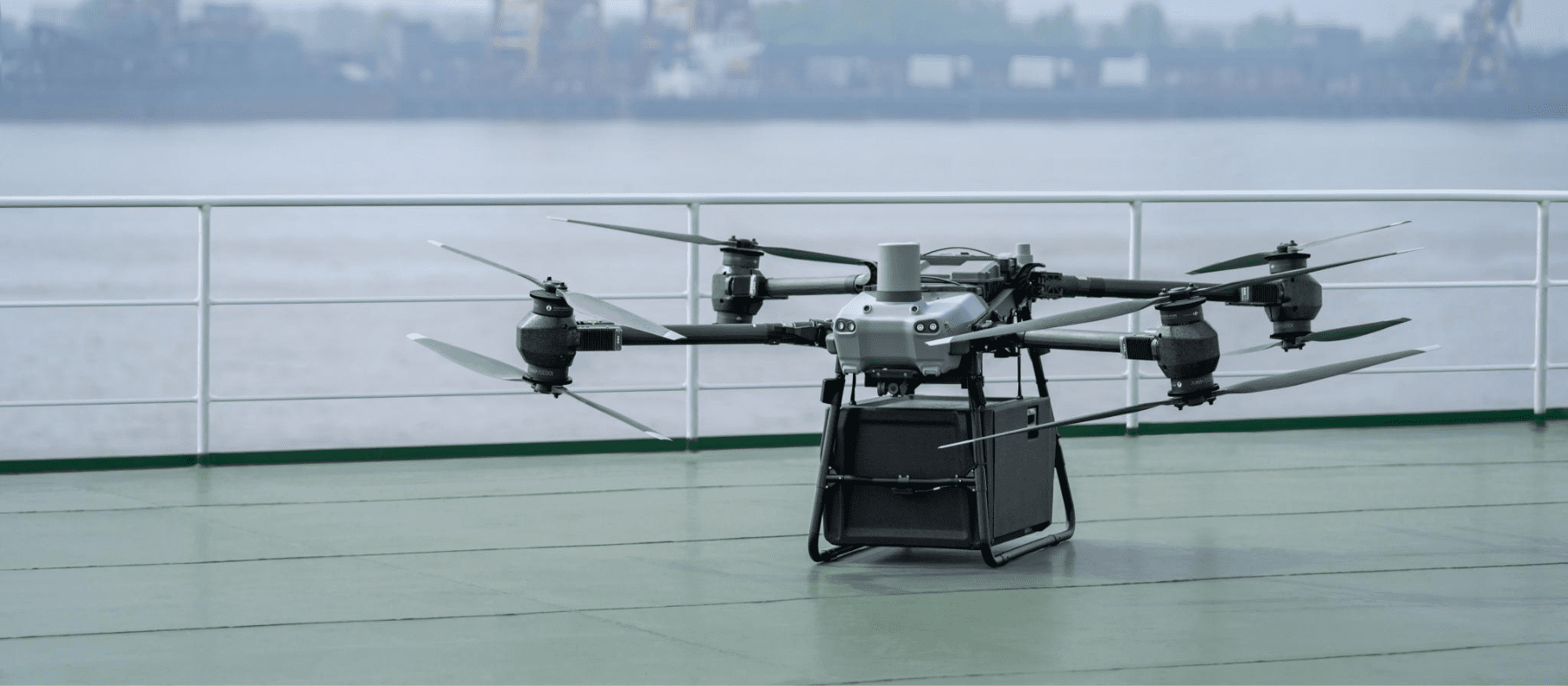
DroneXperts

The official NAV CANADA application In an industry where aviation regulations are constantly evolving, drone pilots in Canada must ensure that they operate in full compliance with current legislation. NAV Drone the official application of NAV CANADA application, has been designed to provide drone operators with an intuitive interface and reliable data, enabling them to […]

dronestechnology

The use of drones in surveying, 3D modeling and geomatics is profoundly transforming data collection methods. Thanks to their on-board sensors (LiDAR, high-resolution RGB cameras, RTK systems, advanced software) drones can now document vast territories with previously unattainable speed, precision and efficiency. In this case study, DroneXperts collaborated with Topo 3D to evaluate the technologi…

Professional drones have been evolving rapidly for several years now. Every year, manufacturers push back the limits of what is possible: flight automation, integration of advanced sensors, improved operational safety and accelerated 3D processing. These innovations are transforming key sectors such as surveying, 3D modeling, engineering, infrastructure inspection and asset management. In a marke…

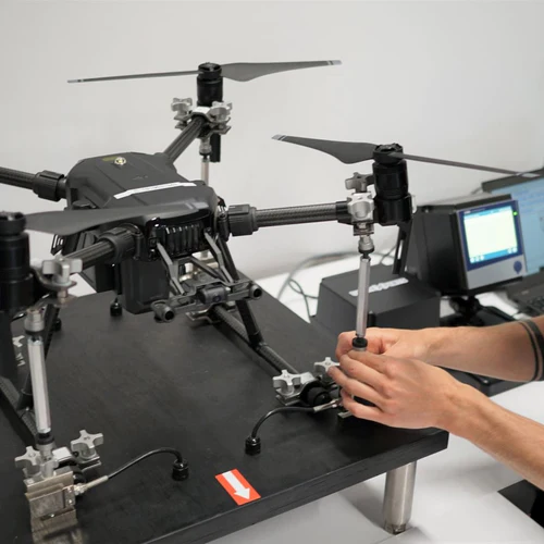
3d-printingdronesengineeringtechnology

In a context where technologies are evolving at high speed, drones now occupy an essential place in industrial, commercial and government operations. In Canada, DroneXperts has established itself as the benchmark for expertise, support and specialized solutions, offering a complete range of services tailored to the needs of professionals and organizations.This article presents the scope […]

Introduction: why are maritime drones revolutionizing the naval sector? Maritime UAVs are emerging as essential tools in the naval field, thanks to their ability to carry out complex missions while reducing human risks and operational costs. By combining robotics, advanced sensors and growing autonomy, these systems enable more reliable data collection, continuous surveillance and rapid […]

dronestechnology

Introduction to the profession of drone pilot You want to become a professional drone pilot ? Whether you’re a curious beginner or an enthusiast looking to turn your interest in aeronautics into a career, you’ve come to the right place. This comprehensive guide tells you everything you need to know about becoming a drone pilot […]

Definition of precision agriculture, what is it? Precision farming refers to a set of practices based on the collection, analysis and use of data to optimize all interventions carried out on a farm. Unlike traditional methods, which apply the same treatments to an entire plot, precision farming adjusts each action to the real needs of […]

agricultureprecision-agriculture

Today, drone operations play a decisive role in emergency response operations: search and rescue, critical inspections, fire surveillance, logistics, reconnaissance before ground crews arrive, and so on. And yet, in these contexts where every minute counts, regulatory constraints remain inescapable. One of the most strategic, and also the most complex, is BVLOS (Beyond Visual Line […]

dronestechnology

Defining bathymetry, its role and importance. Bathymetry is the science of measuring the depths and relief of the seabed to determine the topography of the ocean floor. It is an essential pillar in many fields, from marine environmental studies and industrial installations in underwater areas to fundamental research in undersea geology. By precisely mapping the […]

DJI remains the undisputed leader in aerial LiDAR technologies. With the launch of the Zenmuse LiDAR range, and more recently the Zenmuse L3, DJI now offers ever more powerful sensors for professionals in mapping, surveying, infrastructure inspection and environmental management. In this article, we take a closer look at the Zenmuse L2, its features and […]

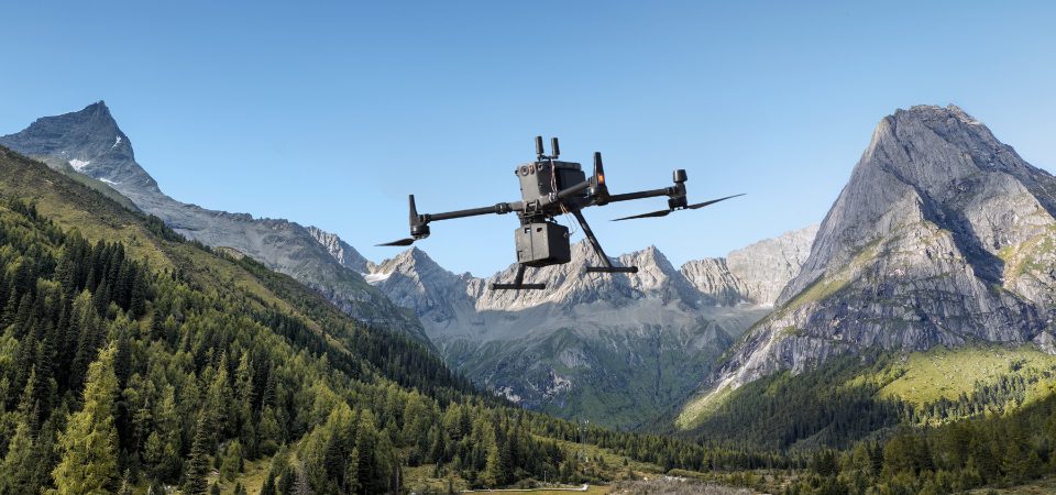
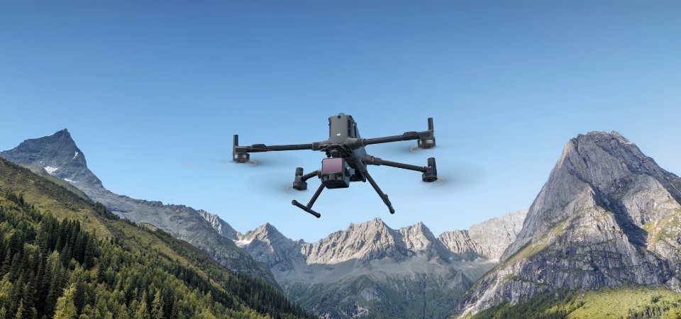
dronesmappingtechnology

Salon de l’agriculture: DroneXperts and agricultural drones Why visit Expo agricole Saint-Hyacinthe? The Salon de l’agriculture is a unique opportunity to discover the innovations that are transforming the agricultural sector. The event features cutting-edge technological solutions, including the increasingly widespread applications of agricultural drones for crop management, precision mapping an…

agricultureagritech

Discover the comparison of the best drones. Which drone is the easiest to fly ? What is the best drone on the market ? Who can fly a drone ? Whether it’s your first time researching or you’re intermediate on the subject of drones, we have the answers to your questions. This guide concerns exclusively […]

dronestechnology

At the dawn of 2026, the Canadian professional drone market continues its spectacular expansion, offering a variety of models designed to meet the specific needs of various sectors. Whether you’re a filmmaker looking for spectacular aerial shots, an engineer needing high-precision infrastructure inspection, or a farmer wishing to exploit cutting-edge tools to optimize crop management, […]

dronestechnology

DJI has just launched its new drone: the DJI Mini 5 Pro, marking an evolution in the Mini range. Aimed at demanding amateurs and content creators alike, it improves on several key criteria: sensor, autonomy, flight functions and obstacle detection. This article describes its new features, technical specifications, strengths and weaknesses, and compares it with […]

dronestechnology

Freight transport by drone is no longer a futuristic concept: it is gradually establishing itself as a real solution to today’s logistics challenges. Among the outstanding innovations, the DJI FlyCart 30 stands out as one of the most promising cargo drones on the market. Developed to ensure fast, safe and efficient deliveries, this drone opens […]

dronestechnology

Do you own a drone, whether for leisure, professional photography or technical operations? Then this article is for you. The drone is an aerial tool in its own right: it flies, it sometimes transports equipment, and it flies over people, buildings or sensitive areas. As with any aerial device, a malfunction can have serious consequences. […]

dronestechnology

Over the past few years, drones have become an essential tool in the construction industry. Much more than just a technological gadget, they are profoundly transforming the way in which construction sites are planned, monitored and managed. Thanks to their ability to rapidly collect precise, visual data, they help increase operational efficiency, reduce inspection costs […]

dronestechnology

Over the past decade, the civil engineering sector has undergone a major transformation, driven by the digitization of processes, the automation of data collection and the massive integration of geospatial technologies. Infrastructure worksites, once dependent on traditional methods that were often long and costly, now rely on modeling, 3D capture and advanced analysis tools. This […]

civil-engineeringengineeringnanotechnology

DJI once again pushes the boundaries of aerial mapping with the launch of the Zenmuse L3, a next-generation LiDAR sensor designed to meet the requirements of professionals in geomatics, civil engineering, forestry, mining and infrastructure inspections. The successor to the Zenmuse L2, already renowned for its precision, the L3 marks a new milestone with extended […]

dronestechnology

What are the best ways to store your drone batteries? Batteries are the energy heart of every drone. They determine not only flight time, but also performance, reliability and safety. Yet they are often neglected when it comes to maintenance and storage. Poor battery management can considerably shorten battery life, impair performance and even present […]

energy-systemsengineering
research.ioresearch.io

Sign up to keep scrolling

Create your feed subscriptions, save articles, keep scrolling.

Already have an account?