We evaluated the effects of fipronil bait pellets on two cricetids that commonly occupy colonies of black-tailed prairie dogs ( Cynomys ludovicianus ; BTPDs): western deer mice ( Peromyscus sonoriensis ) and northern grasshopper mice ( Onychomys leucogaster ). In one experiment, bait pellets (0.96 mg fipronil/bait) were applied at 75 baits/ha to three 1.44-ha plots on a BTPD colony. Mouse abundan…
Melanistic lesions, including non-raised black areas due to proliferations of melanocytes and melanomacrophages in the dermis and epidermis, as well as raised black areas consistent with melanoma, are described in brown bullhead (BBH) Ameiurus nebulosus from three water bodies in the northeastern United States and Quebec, Canada. First observed in the Vermont portion of Lake Memphremagog, Vermont…
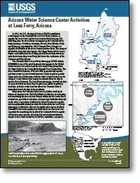
Introduction In 1921, the U.S. Geological Survey (USGS) established a streamgage on the Colorado River at Lees Ferry, Arizona, to monitor the river’s flow and level as it enters Grand Canyon. The following year, the seven States encompassing the Colorado River Basin (Arizona, California, Colorado, Nevada, New Mexico, Utah, and Wyoming) negotiated the 1922 Colorado River Compact to regulate distri…
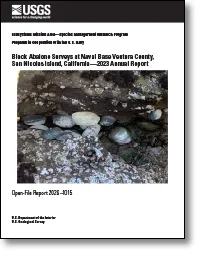
The U.S. Geological Survey monitors a suite of intertidal black abalone ( Haliotis cracherodii ) sites at San Nicolas Island, California, in cooperation with the U.S. Navy, which owns the island. The nine rocky intertidal sites were established in 1980 to study the potential effect of translocated sea otters on the intertidal black abalone population at the island. The sites were monitored from 1…
In unconventional petroleum reservoirs hydrocarbon fluids are hosted by both mineral and organic matter pores. These pores can have diameters that range from microns to less than a single nanometer and, for unconventional reservoirs, there is evidence that small pores ( <20 nm diameter) may constitute a large proportion of the available space. Understanding subsurface volumes and how fluids behav…
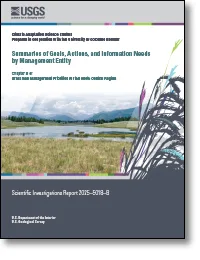
The grasslands in the North Central region are managed by a diverse group of Federal, State, and Tribal agencies; nongovernmental organizations; partnerships; and private landowners. This chapter highlights these various grassland management entities, provides background information on their mission and organizational structure, and describes some of their key grassland management activities, inc…
Wet tropical forests are experiencing rising temperatures and increased frequency and intensity of extreme climatic events, such as cyclones, which can increase rates of soil erosion and surface runoff. Fungal litter mats, formed by agaric decomposer fungi, play a crucial role in stabilizing slopes, preventing erosion, and aiding nutrient cycling; however, little is known about how warming affect…
Overfishing, habitat loss, and pollution caused the extirpation of Lake Sturgeon ( Acipenser fulvescens ) throughout much of the Great Lakes. A Lake Sturgeon reintroduction program using two rearing strategies began in 2018 in the Maumee River, a tributary of Lake Erie. We assessed the movement of streamside or traditionally reared age-0 Lake Sturgeon using acoustic telemetry to determine if rear…
Methane (CH 4 ) is a potent greenhouse gas, and tropical forests account for roughly one–third of global atmospheric CH 4 uptake by soils. Projected warming and more frequent hurricanes in these ecosystems may alter soil CH 4 sink strength, as warmer and wetter soils enhance methanogenesis activity. We measured soil CH 4 and CO 2 efflux during the calendar summer months of 2023 and 2024 alongside…
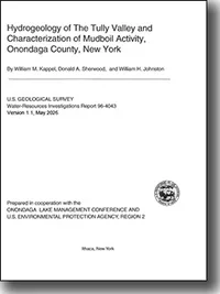
Mudboil activity in the Tully Valley, in central New York, is causing turbidity in nearby Onondaga Creek, where it has caused a bridge to collapse; it also has threatened or damaged other structures and has caused extensive land subsidence. Mudboil activity was intermittent from its first reported appearance in the 1890's until the 1970's, when the rates of mudboil discharge and land subsidence b…
Underground coal mines are important global sources of methane, but emission estimates are uncertain. We show that emission estimates for individual mines from aircraft remote-sensing surveys in the United States agree within 40% with direct measurements used for national emission reporting (IPCC Tier 3 estimate). Such direct measurements are unavailable in most countries, which rely on estimated…
Objective People are exposed to mercury (Hg) through the consumption of fish. State and federal governments provide broad, often-generalized food safety guidance to reduce exposure; however, numerous rural fishing areas lack testing and location- or species-specific guidance. The aim of this study was to provide tangible, visible, or easily measured characteristics of Lake Trout Salvelinus namayc…
Some staging regions support multiple groups of the same migratory species, each of which may use the region differently. Characterizing the ways, in which separate groups use such regions can therefore help to identify vulnerabilities during this sensitive period of the annual cycle. The Prairie Pothole Region (PPR) is a massive wetland complex in the northern Great Plains of North America used …
The Delaware Basin region of west Texas and southeast New Mexico has become one of the most prolific regions of seismic activity in the continental United States due to widespread hydraulic fracturing and wastewater disposal injection. In response to the increased number of earthquakes in this region, rapid and accurate characterization of earthquake sources is necessary to understand the evoluti…
Background Prescribed fire is a common approach to reduce fuels and mitigate fire hazards. The accumulation of live and dead fuels following initial treatment means that repeated application of prescribed fire could be used to maintain this benefit. However, the effect of repeated prescribed fires is not well documented in many dry coniferous forests in the western United States. Here, we present…
In the United States, cooling-dominated commercial building loads can cause geothermal heat pump-based district energy systems to accumulate a long-term subsurface thermal imbalance, motivating the incorporation of seasonal underground thermal energy storage. We developed a transferable workflow to evaluate geothermal district systems that pair ground heat exchangers with seasonal underground the…
Drones are useful for wildlife research and management, but they can cause disturbance and harassment to wildlife. Sea otters ( Enhydra lutris ) are candidates for drone-based observation and monitoring but are vulnerable to disturbance. No studies have evaluated drone effects on sea otter behavior, but based on prior disturbance studies, we hypothesized: (1) sea otters would exhibit behaviors in…
Anthropogenic pressures are driving changes in eelgrass communities, which are altering baseline conditions in estuarine environments. Field detections have validated the transport of land-sourced pollutants to aquatic systems; however, studies rarely sample concurrently for pesticides, and pharmaceuticals and personal care products (PPCPs) across environmental compartments. Moreover, studies on …
Major waterways in the City of Roanoke (City) have failed to meet Virginia’s aquatic life designated use since 1996. Segments of the upper Roanoke River lack healthy benthic macroinvertebrate communities which prompted a total maximum daily load (TMDL) study by the Virginia Department of Environmental Quality (VDEQ) to identify the most probable stressor(s) causing the impairment. Excess fine sed…
We produced a 30-m resolution binational land cover map of Bird Conservation Region 33 (BCR 33) for the U.S. North American Bird Conservation Initiative. The region covers large portions of the Sonoran and Mojave Deserts. The map can support the U.S. Fish and Wildlife Service (FWS) Migratory Bird Program’s recovery planning efforts and constitutes the first known binational land cover dataset spa…
biodiversitybiologyconservationenvironment
research.io
Sign up to keep scrolling
Create your feed subscriptions, save articles, keep scrolling.