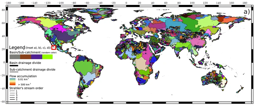
The Hydography90m dataset » Click here for the visualization « We used the MERIT Hydro Digital Elevation Model at 3 arc-sec (∼90 m at the equator) to derive a globally seamless, standardised hydrographic network, the “Hydrography90m”, with corresponding stream topographic and topologicalinformation. A central feature of the network is the minimal upstream contributing area, i.e. flow accumulation,of 0.05 km2 (or 5 ha) to initiate a stream channel, which allowed us to extract headwater stream cha