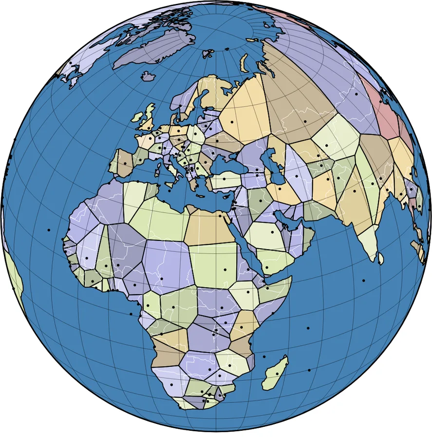
World territories have been redrawn so that a region is determined by the closest capital city. This is calculated using a spherical Voronoi diagram, which takes into account the curvature of the Earth when computing distances. See also United States of Voronoi.