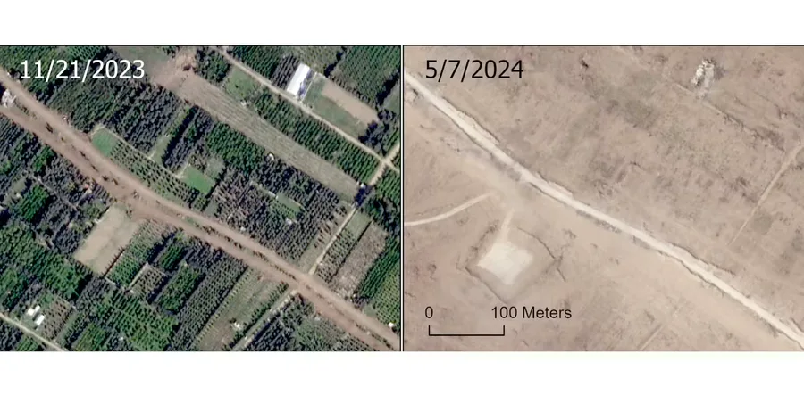
Remote sensing – The Conversation3d agoGaza: we analysed a year of satellite images to map the scale of agricultural destructionJamon Van Den Hoek, Associate Professor of Geography, Oregon State UniversityRead at Remote sensing – The ConversationShareLess like thisTagsagriculturecrop-sciencesustainable-farming