
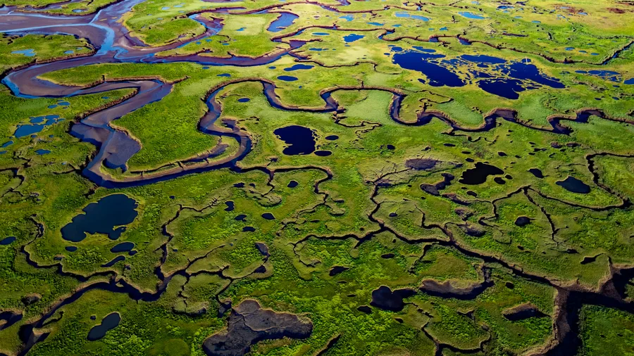
The coast is clear-er: NOAA unveils new land cover maps 900 times greater in detail June 2, 2026 This image is of a salt marsh in coastal Maine. The high-resolution, land cover mapping NOAA has done for the state captures the tidal creeks, pannes, pools and vegetation with far greater precision and detail than past, 30-meter mapping. (Image credit: NOAA) Download Image NOAA is releasing new, higher-resolution land cover maps for coastal Alabama, Mississippi, Northeastern Ohio, Rhode Island, and
The coast is clear-er: NOAA unveils new land cover maps 900 times greater in detail
genevieve.contey