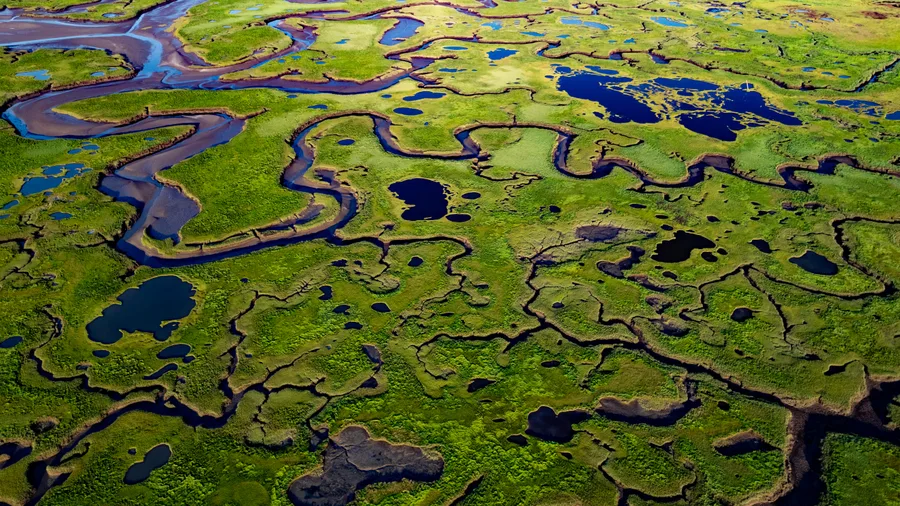
The coast is clear-er: NOAA unveils new land cover maps 900 times greater in detail June 2, 2026 This image is of a salt marsh in coastal Maine. The high-resolution, land cover mapping NOAA has done for the state captures the tidal creeks, pannes, pools and vegetation with far greater precision and detail than past, 30-meter mapping. (Image credit: NOAA) Download Image NOAA is releasing new, high…
climate-scienceenvironmentland-cover
Frontiers in Environmental Science | New and Recent Articles
This study investigates the intensity of Land Surface Temperature (LST) and the Urban Heat Island (UHI) effect across Lahore District and its surrounding urban and peri-urban areas. Landsat satellite data were utilized to examine the spatiotemporal patterns of LST, identify UHI zones, and assess changes in land use and land cover (LULC), the Normalized Difference Built-up Index (NDBI), the Normal…