


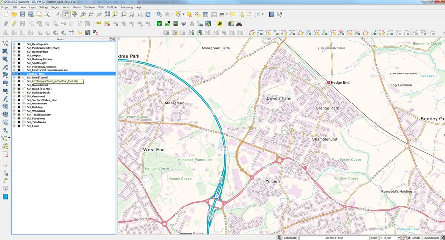
QGIS Ordnance Survey Opendata Styles Ordnance Survey have released Style Sheets for their #opendata including ESRI (ArcGIS) and Quantum GIS (QGIS) style sheets. Most strikingly for the Vector Map District Product that is one of the best full Great Britain datasets everyone can download from https://www.ordnancesurvey.co.uk/ opendatadownload/products.html Nice looking vector data in QGIS using Vector Map District Data from Ordnance Survey Opendata. (Yes motorways in the UK are blue....) But you can change that if you want. You can download the stylesheets from http://www.ordnancesurvey.co.uk/resources/carto-design/ cartographic-stylesheets.html And Charley Glynn sent me a twitter message that these stylesheets and associated files are available on github here:. https://github.com/OrdnanceSurvey/OS-VectorMap-District-stylesheets/tree/master/ESRI%20Shapefile%20stylesheets/ QGIS%20stylesheets%20(QML)/Full%20Colour%20style Couple of notes before the quick guide to help you get going... Install the font provide first - see quick guide below. The shapefiles have a classification field that is truncated (shapefile truncates field names) but if change to CLASSIFICA it will work. See this screenshot. Quick Guide 1. Fork or download the contents of this repository 2. Copy the font file 'OS_VMDistrict.otf' into your systems font directory (on Windows machines this is (C:\Windows\Fonts) Your machine may require a restart for QGIS to recognise this new font 3. Load your OS VectorMap District ESRI Shapefile data into QGIS 4. Double click on a layer to access the 'Layer Properties' window > click on 'Load Style...' > navigate to the directory containing the QML files (those ending .qml) > select the QML file that corresponds to that layer > click 'Open' > click 'OK' Repeat step 4 for all layers 5. Although every feature is styled, for use as a contextual map we recommend the following layer order and visibility: Recommended viewing the map between 1:10,000 and 1:25,000 for maximum legibility I have even reprojected the data to Web Mercator and got the Bing Aerial Imagery as a background. Just styles need reversing on a dark background, this uses the Openlayers plugin, the only restriction is making the imagery transparent to 'fade' the imagery down then less contrasting colours can be applied to the background. The only addition I made was adding the OS Vector Contours from the OS 50 Terrain Dataset - just for a bit more details in the rural areas of England. Overall it is well worth downloading the styles and playing around with QGIS and the styles. Mapperz Mapping News Blog
QGIS Ordnance Survey Opendata Cartographic Styles
noreply@blogger.com (Mapperz)
Tags