Coweta county could become third in state history to stage referendum, letting residents challenge a policy or decision A post-church downpour didn’t deter hundreds of people from showing up at Morgan’s Market on a recent Sunday afternoon to sign a petition aimed at giving people in rural Coweta county, Georgia, the chance to vote on a datacenter known as Project Sail and prohibit other datacente…
political-sciencesocial-scienceurban-studies
News from California, across the nation and world - Los Angeles Times
Tonopah has boomed and mostly busted since it's heyday more than a century ago. Trump has raised expectations for renewed prosperity and one local businessman is sprucing up his motel in anticipation of better times.
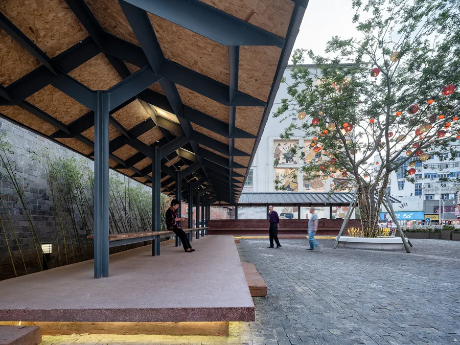
Śhālā Twam, meaning "a space for you," emerged from a simple yet urgent question: within the rapidly densifying urban condition of Kerala, can even a modest private plot become a shared cultural and ecological resource for the neighbourhood?
A new state law that allows denser housing development near major transit stops goes into effect in July, opening the door to construction of more than 1 million new units in California's urban centers.
Humanities and Social Sciences Communications, Published online: 08 June 2026; doi:10.1057/s41599-026-07528-x Decoding the impact of urban form on energy efficiency in shrinking cities: dynamic evolution, spatiotemporal transitions, and SHAP analysis
Protected bike lanes increase Citi Bike ridership in New York City, but painted bike lanes and sharrows do not show a statistically significant causal effect on ridership after accounting for confounding factors, according to a new study from researchers at NYU's Tandon School of Engineering .
It may seem like it’s impossible to find a car park on the street. As a recent Grattan Institute report makes clear, Australia actually has an oversupply of parking, both on streets and in parking lots. Across five of the state capitals, most postcodes have more on-street spaces than there are registered cars. That’s great […] The post Curbside parking is great for drivers—but terrible for everyo…
Humanities and Social Sciences Communications, Published online: 06 June 2026; doi:10.1057/s41599-026-07867-9 Exploring the driving mechanism and scenario prediction of the spatialtemporal pattern of resilience of urban agglomerations in the middle reaches of the Yangtze River
China has an extensive number of small towns with historic districts boasting natural and organic spatial fabric mainly composed of self-built houses. Nevertheless, these areas are generally trapped in tough regeneration predicaments: the deterioration of physical spaces has disrupted the social ecosystem, resulting in hollowing-out, an aging population and a severe loss of vitality; meanwhile, t…
Introduction Selecting an appropriate location for healthcare infrastructure is an important task in urban and regional planning. Geographic Information Systems (GIS) provide powerful spatial analysis tools that help planners identify suitable locations based on multiple criteria. This project demonstrates a Hospital Suitability Analysis workflow developed using QGIS. The objective of the study i…
What happens when a city’s industrial past becomes the raw material for its future? In Copenhagen , Nordhavn transforms the old harbor into a living laboratory of sustainable urbanism , where warehouses and docks give way to independent districts, small islands, and canals that redefine what it means to inhabit the city.
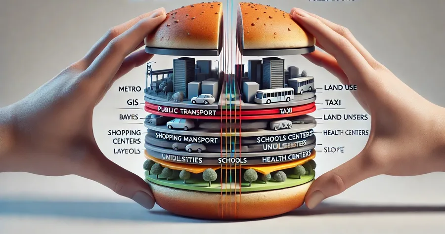
Modern cities are running on performance indicators. They move millions of people each day, concentrate capital, separate land uses, and sustain complex systems of logistics and consumption. In that sense, the city functions as a system to be continually adjusted and optimized.
Can a neighborhood really function as a "15-minute city"? Researchers put the concept to the test by analyzing travel patterns in nearly 200 transit station communities across the Portland and Washington metropolitan areas. Using large-scale mobility data and machine learning, they found that access to jobs - not mixed-use development or car ownership - is the strongest predictor of people stayin…
New York City continues to face one of the most severe housing shortages in the United States. Rising rents, limited housing supply, and increasing demand have pushed city leaders to explore new strategies to accelerate residential development. One initiative generating significant attention is the NYC Block by Block Housing Plan.
Can urban accessibility be measured beyond simple distance? Our 2026 study introduces a friction-aware fuzzy RS–GIS framework integrating topography and accessibility to support more equitable and sustainable urban planning.
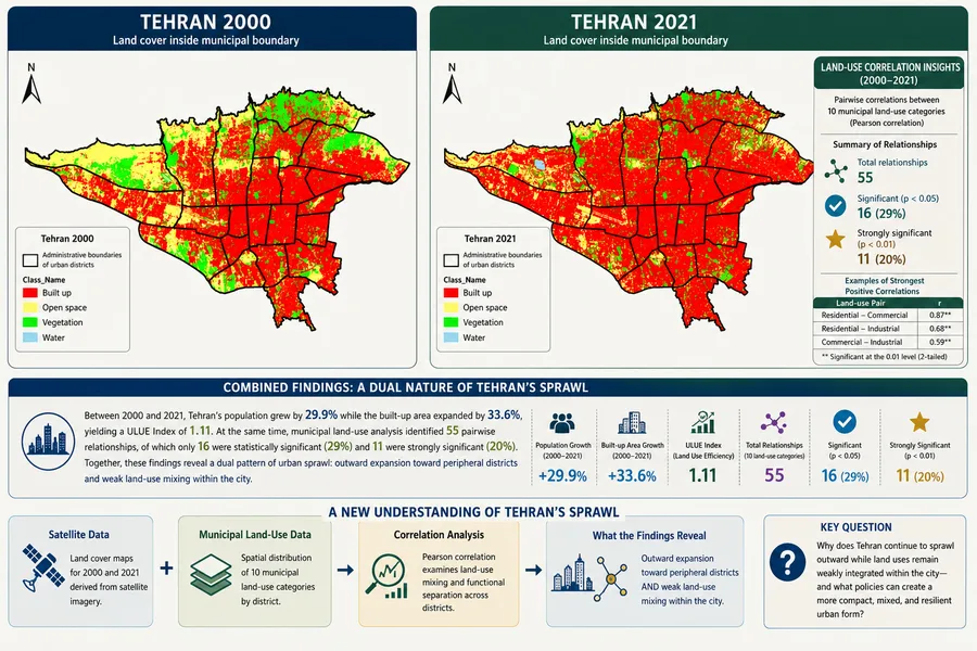
Tehran’s sprawl is not only outward growth. Our study combines satellite and municipal land-use data to reveal low-density peripheral expansion, weak land-use mixing, longer trips, and rising air-pollution pressure.
Tehran's average Route Factor is 1.52, meaning trips between its 22 districts are about 52% longer than direct distances. While indicating moderate network efficiency, this highlights important planning challenges related to air pollution, car dependence, and fragmented land use.
The housing abundance movement has won more of the intellectual argument than anyone might have predicted a decade ago. Across much of American politics, even in Zohran Mamdani’s New York (listen, I love the guy), it is now at least possible to say out loud that we have too many pointless rules making it impossible […]
political-sciencesocial-scienceurban-studies
research.io
Sign up to keep scrolling
Create your feed subscriptions, save articles, keep scrolling.