
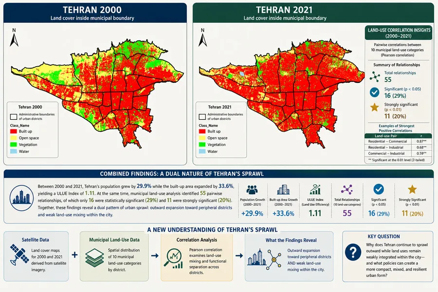
Tehran’s sprawl is not only outward growth. Our study combines satellite and municipal land-use data to reveal low-density peripheral expansion, weak land-use mixing, longer trips, and rising air-pollution pressure.
Can Tehran Become a 15-Minute City? Revealing Hidden Urban Sprawl Through Satellite and Municipal Data: Lessons from Melbourne (Australia), Barcelon (Spain), and Paris (France)
Amir Ghahremanlou