
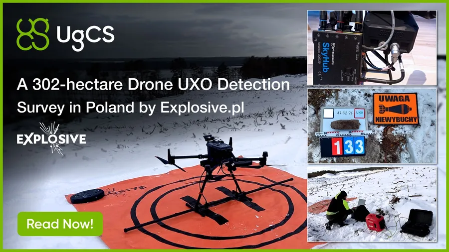
Explosive.pl surveyed 302 hectares of coastal terrain in Poland using a DJI M350 RTK with SENSYS MagDrone R4 magnetometer. UgCS for flight planning, SkyHub for True Terrain Following. 3000 anomalies detected, live ordnance recovered.
Case study: Poland 302-Hectare drone UXO survey with magnetometer | SPH Engineering
Tags